ReadPaper Blog
ABot-Earth 0.5: Generative 3D Earth Model
ABot-Earth 0.5 is a generative 3D framework from AMAP CV Lab, Alibaba Group, designed to synthesize large, seamless Earth-scale 3D environments from geospatially referenced satellite imagery. The paper addresses the cost and latency limits of conventional photogrammetry and LiDAR reconstruction by learning a native 3D Gaussian Splatting generation space from real-world urban reconstructions, enabling scalable generation, interactive multi-LOD visualization, and simulation-ready environments.
Source: (none provided)
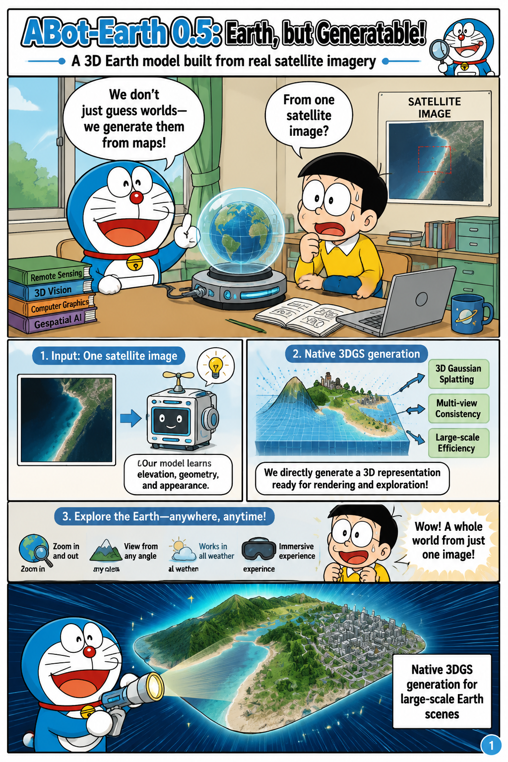
ABot-Earth 0.5: Earth, but Generatable!
The paper introduces ABot-Earth 0.5 as a generative 3D Earth model that turns standard geospatially referenced satellite imagery into large-scale, near-seamless 3D aerial scenes. Its central problem is that planetary-scale 3D modeling remains difficult when systems must produce realistic geometry, textures, and geographic consistency without exhaustive multi-view capture at every location. The proposed approach formulates generation directly in the 3D Gaussian Splatting representation, rather than treating 3DGS only as a post-processing or reconstruction format. By conditioning on ubiquitous satellite imagery, the framework uses a globally available signal that can be associated with real coordinates across the Earth. The paper argues that this combination of satellite conditioning and native 3DGS generation makes it possible to synthesize realistic urban and natural environments at scales that conventional reconstruction pipelines struggle to reach.
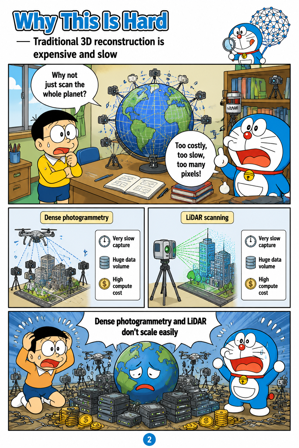
Why This Is Hard
The motivation section frames high-fidelity 3D geospatial reconstruction as essential for digital twins, smart city logistics, disaster response, urban planning, and robotic exploration. The paper identifies dense oblique photogrammetry and LiDAR scanning as powerful but poorly suited to on-demand planetary modeling because they require expensive acquisition, long processing pipelines, and substantial computation. It also critiques many large-scale outdoor generative systems for relying on synthetic assets or unconstrained hallucination, which weakens their physical and geospatial authenticity. This limitation is especially important for simulation because artificial environments can preserve a severe sim-to-real domain gap. ABot-Earth 0.5 is positioned as a response to both bottlenecks: it reduces dependence on exhaustive scanning while grounding generation in real-world 3D reconstructions rather than purely synthetic worlds.
The Trick: Learn From Real 3DGS Cities
A key methodological contribution is the paper’s data pipeline, which uses city-scale 3DGS scenes as training data produced by the ABot-3DGS reconstruction engine. The pipeline collects real-world imagery from satellite, aerial, and urban sources, standardizes coordinates and metadata, reconstructs large scenes, partitions them into spatial tiles, renders multi-view training samples, and applies multi-granularity quality assessment. The satellite pathway includes multi-stereo orbital imagery and public sources such as DFC 2019, with FromOrbit2Ground using a Z-Monotonic SDF for watertight urban geometry and a diffusion-based restoration network for facade textures. The aerial and urban pathways incorporate high-resolution oblique imagery, optional LiDAR or photogrammetric mesh priors, street-view videos, drone footage, and datasets such as UrbanScene3D, Mill-19, and UC-GS. By training on real 3DGS reconstructions curated at tile, view, and dataset levels, the model is intended to learn genuine urban geometry, vegetation, roads, facades, and textures rather than relying on hand-built synthetic assets.

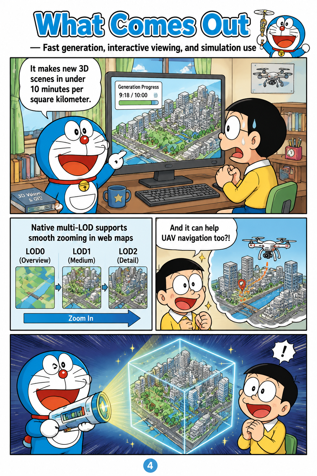
What Comes Out
The paper reports that ABot-Earth 0.5 can synthesize novel 3D scenes conditioned solely on satellite imagery at a scalable rate of under 10 minutes per square kilometer. Its native 3DGS formulation is presented as a way to preserve rendering realism while representing complex non-manifold outdoor content such as dense foliage, building facades, and specular water surfaces. The system also generates hierarchical level-of-detail structures, allowing outputs to be streamed and visualized interactively in web-based map engines. In the described deployment, a customized YunJing-based 3DGS visualization engine supports viewport-dependent tile scheduling and streaming of trillion-scale Gaussian primitives. The paper connects these capabilities to downstream Embodied AI applications, especially closed-loop UAV navigation, obstacle avoidance, and control, where realistic geometry and multi-view consistent textures can improve simulation fidelity.
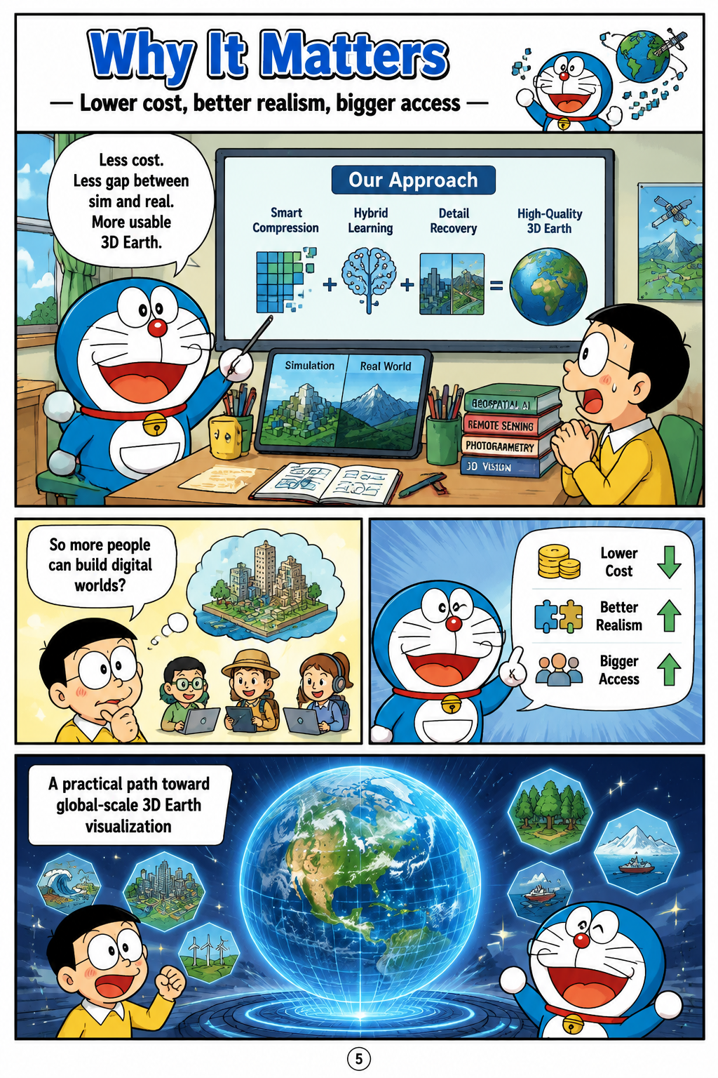
Why It Matters
The broader implication of ABot-Earth 0.5 is that generative 3D modeling may lower the technical and financial barriers to global digital Earth construction. The paper emphasizes that training on real-world reconstructions and conditioning on geospatial imagery can reduce the synthetic-to-real gap that limits many virtual simulation environments. It also highlights composability, because generated 3DGS environments can be integrated and co-edited with precisely reconstructed landmark models for hybrid high-fidelity scenes. The authors present the framework as relevant to smart city planning, environmental monitoring, rapid disaster response, geographic information systems, and simulation platforms for embodied agents. Its claimed value lies not only in visual realism, but in making large-scale 3D Earth visualization and simulation more accessible through efficient generation, native multi-LOD outputs, and globally available satellite inputs.